Puigsacalm from Coll de Bracons: route, difficulty and advice
How to hike Puigsacalm from Coll de Bracons: route details, difficulty, parking and honest advice for reaching one of La Garrotxa's finest summits.
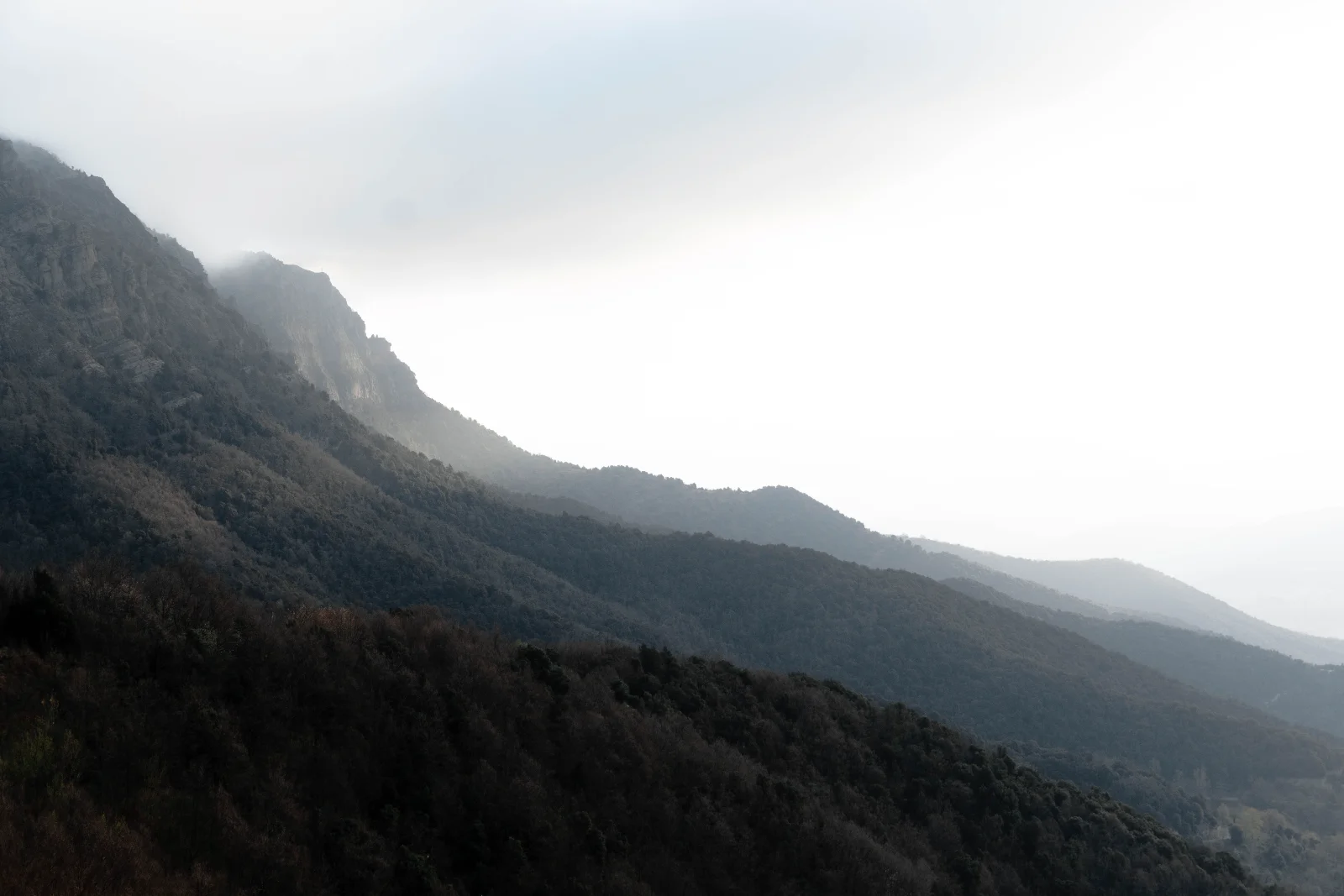
Puigsacalm is not a gentle stroll between volcanoes or a viewpoint located ten minutes from a car park. At 1,514 metres, it is one of La Garrotxa's emblematic mountains and an exceptional balcony over the Vall d'en Bas, the Pyrenees and much of central Catalonia.
The best route for a first ascent begins at Coll de Bracons. It is the friendliest approach, but still involves roughly five hundred metres of climbing, sustained uphill sections and about four hours of walking. Friendly does not mean effortless.
Route summary
- Starting point: Coll de Bracons.
- Approximate distance: 9.5 kilometres return.
- Approximate ascent: 544 metres.
- Estimated time: between 3 hours 30 minutes and 4 hours 30 minutes.
- Difficulty: moderate for regular walkers.
- Route type: out and back along the same trail.
- Summit altitude: 1,514 metres.
Figures vary slightly according to the parking position, minor diversions and the device recording the route. Check the official Puigsacalm overview and carry a downloaded route or suitable map.
Getting to Coll de Bracons
From the Vall d'en Bas, a narrow surfaced road climbs from Joanetes to Coll de Bracons. The road has numerous bends, and the pass marks the boundary between La Garrotxa and the neighbouring comarca of Osona.
There is no large organised car park. Vehicles use safe spaces beside the road, which fill early on popular weekends. Do not obstruct the carriageway, block private access or park somewhere that forces other drivers across the centre line.
Arriving early is not merely romantic advice about watching the sunrise. It is the most practical way to find a space and avoid beginning the hike with a complicated negotiation involving twenty other cars.
In winter, check road conditions and the possibility of ice. If access or weather conditions are unclear, change the plan. Puigsacalm will remain available when the weather improves.
From Coll de Bracons to Font Tornadissa
The trail begins directly at the pass, climbing a small rocky step beside the road. This is not rock climbing, although most people use their hands briefly. Signs then indicate Puigsacalm and Font Tornadissa.
The first part passes mainly through a beech forest. The path alternates between easy sections and short climbs before crossing the Collet de Sant Bartomeu. Autumn makes the forest particularly attractive, while fallen leaves do an excellent job of hiding roots and loose stones.
Font Tornadissa stands in a clearing surrounded by forest and pasture. It is a natural place to pause before the more sustained climb. Carry your own water: a spring marked on a map does not guarantee a reliable flow or tested drinking water.
From Font Tornadissa to the summit
Beyond the spring, the trail climbs through pasture towards the Rasos de Manter. The slope becomes more noticeable, but the landscape opens and views begin to appear over the neighbouring mountains.
The final approach combines open grassland and mountain paths. In normal dry conditions, it has no major technical sections. Mud, fog, snow or ice change the difficulty completely.
The summit has a trig point and an extensive panorama. On clear days, you can see the Pyrenees, the Vall d'en Bas, Collsacabra, the plain of Vic and other ranges across central Catalonia. Sunshine in the valley does not include a contractual guarantee of visibility at the top.
The summit is exposed to wind and lies close to steep drops. Watch children carefully, stay back from edges and add a warm layer before you become cold.
Return along the same route. Descending is usually faster but puts more strain on knees and increases the chance of slipping. Save water, concentration and some energy for the return journey.
Is this an easy hike?
The Coll de Bracons route has no significant technical difficulty when conditions are dry. It does, however, involve several hours of walking and more than five hundred metres of cumulative ascent.
For an active person accustomed to hiking, it is a moderate route. For someone who only walks on city streets, it may feel demanding. A mountain does not change category simply because an app colours the trail green.
The route is unsuitable for pushchairs. Children experienced in mountain walking may complete it in suitable weather and at an appropriate pace. Do not turn reaching the summit into an obligation if the group stopped enjoying the day an hour earlier.
The Ganxos routes from Joanetes
Puigsacalm can also be climbed from Joanetes using the Ganxos Nous or Ganxos Vells routes. These are substantially more demanding, with considerable ascent, exposed terrain and sections equipped with metal steps or handholds.
We do not recommend these alternatives for a first ascent, inexperienced hikers or anyone uncomfortable with heights. Dramatic photographs are not a useful method for assessing whether a route matches your ability.
Rockfalls, closures or changes to the equipment can affect these paths. Check current conditions before setting out. Turisme Garrotxa presents the Ganxos Nous option as a demanding guided traverse.
The best time to hike
Spring and autumn usually provide the most comfortable temperatures and particularly attractive forests. In autumn, leaves hide uneven ground and weekends can be busy.
In summer, start early to avoid heat and afternoon storms. The forest provides considerable shade, but the upper slopes and summit remain exposed.
In winter, snow, ice, wind and limited daylight can transform the route. Without suitable experience and equipment, choose another day. Turning around is considerably wiser than becoming a local news story.
Check a mountain forecast rather than relying only on the weather predicted for Olot. Conditions in the valley and on the summit can differ substantially.
What to bring
Wear hiking footwear with a reliable sole. Carry sufficient water, food, sun protection, a warm layer and a waterproof jacket. Download the route and map for offline use.
Do not depend entirely on a phone. Cold temperatures reduce battery life, coverage may disappear and a line on a screen cannot interpret fog on your behalf.
Tell someone which route you are taking and when you expect to return. Carry out all rubbish and avoid shortcuts that contribute to erosion.
What to do afterwards
Sant Privat d'en Bas, Joanetes and Els Hostalets d'en Bas provide good places to finish the day without adding another major walk. Book ahead if you expect a late lunch: returning from a mountain does not automatically reopen a closed kitchen.
If weather prevents the ascent, choose the Xenacs viewpoint, the Carrilet greenway or the villages of the Vall d'en Bas as less exposed alternatives.
The verdict
Hiking Puigsacalm from Coll de Bracons is one of La Garrotxa's finest mountain days. The route combines beech forest, open pasture and a summit with enormous views, without technical passages in normal dry conditions. It remains a mountain route: start early, check the forecast, carry water and turn around when necessary. The summit is optional; returning safely is not.